Thursday, December 6, 2012

Yakima Climate Controls and Comparison


Yakima has a very unique climate because of the climate controls that influence the area. A few meso-scale situations effecting the area are the atmospheric circulations, its proximity to the Pacific ocean and orthographic influences from the Cascade mountain range. As stated in my previous blog, Yakima can be influenced by maritime tropical (mT) and continental polar (cP) fronts. The moist maritime tropical does not bring much precipitation to the area because orthographic lifting causes much of the moisture to dump on the west side of the mountain range leaving little that reaches the east. But the front does produce slight humidity in the area.


http://www.personal.psu.edu/gmm5106/blogs/meteorology_410/se.html
The digital elevation map above shows the Cascades and how they can be a huge topographic barrier effecting the climate of the Yakima Valley.
The continental polar air effects the area mainly in the winter when the jet stream lowers. This brings dry cold air with not a lot of precipitation resulting in low snowfall rates compared to other states at that latitude. During the summer, Yakima receives some humidity from continental tropical (cT) air that eludes the Cascades and enters from the southwest. The Cascades definitely have an effect on the area. Not only do the mountains block moisture they aid in the warming and extreme temperatures in the summer. As the air mass travels over the Cascades, it warms according to the dry adiabatic lapse rate and enters the Yakima Valley. The area also experiences Chinook winds that build up seed coming down the mountains and blow through the valley. 
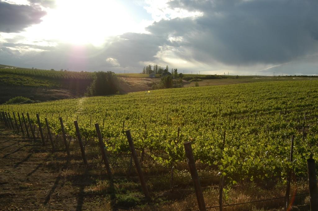
The area also experiences some micro-scale situations affecting the climate especially its proximity to irrigation. Yakima has a cute nick-name which is the “Palm-Springs” of Washington. The area is known for its agriculture. There are many apple orchards and vineyards. The area is not a naturally lush area because of the lack of precipitation. So most of the agriculture and economy of Yakima is dependent on irrigation. Lots of irrigation results in increased humidity due to transpiration and evaporation.


The graph I made above shows the average temperature and precipitation of Yakima. The data I found is the average for the period of 1961-1990. The relationship in the graph shows that higher temperature coincides with low precipitation and low temperature coincides with higher precipitation. This also coincides with the air masses that effect the area. The continental polar brings snow in the winter because the orthographic effect is not as important with this front. The maritime tropical cannot bring the moisture in the summer as it is blocked by the Cascades.


http://lindenhillsweather.blogspot.com/
The map above was displayed in Sam's blog. It shows the jet streams for the winter and summer. Even though the two cities are at similar latitudes, they are affected differently by the jet stream and the air masses.

I compared my blog to Sam Epperly's blog on Minneappolis, MN. I chose this location because it has a similar latitude but different environmental effects.  They both receive cold dry air in the winter from the continental polar fronts. This causes the two areas to have really cold temperatures from the air masses. The maritime tropical air effects the two regions differently. Yakima receives a little precipitation and humidity from the maritime tropical air from the pacific. Minneappolis recieve a much warmer and moisture filled maritime tropical air from the Gulf Coast. This brings a lot more precipitation to the area and thunderstorms. It also creates a great environment in the state for tornados which is something that is not really experienced in the Yakima valley. I think Sam's blog and my blog are great examples of how locations at the same latitude are affected by so many different environmental situations to create different climates.
 Sam's blog link: http://lindenhillsweather.blogspot.com/

References:
http://www.wrcc.dri.edu/cgi-bin/clilcd.pl?wa24243

Wednesday, November 14, 2012

Air masses effecting Yakima, WA

The digital elevation map (DEM) above shows how the Cascades block Yakima
from maritime polar or maritime tropical air masses.
Yakima, WA is unique and quite different from the better known Seattle area. Yakima is in the rain shadow of the Cascades and its virtually blocked off from the moist cool air that the western half of the state receives.
 
 
The map above shows the general direction of the different air masses.


Rarely, Yakima receives hot maritime tropical (mT) air in the summer and cold dry continental polar (cP) air in the winter moving in from the west.


This map shows the dry arid region of the Yakima Valley just
east of Seattle and Portland.


 But the air masses must fight the topographic barrier of the Cascades to reach the eastern side of the state. This battle causes them to lose a lot of moisture along the way leaving Yakima an arid desert region. The mountain range also protects the eastern side from mid latitude cyclones and the moisture that comes with it.
Hills outside Yakima with winter frost
In the winter, Yakima can receive dry continental polar (cP) air when it comes from the north or east. The Yakima valley experiences Chinook winds much like Denver does in the winter. After the continental tropical air mass releases its moisture in Seattle and along the Cascades it warms coming down the mountains creating warm strong winds for the eastern plains. 


Beautiful vineyards of theYakima Valley


In the summer, the area receives continental tropical (cT) that results in low relative humidity and high temperatures. Yakima Valley is known for its agriculture, producing apples and wine from large vineyards. The agriculture of the area would not be possible without runoff from the mountains and the mild humidity the area receives in the summer.
Yakima is quite unique for its latitude. Because of the mountains, the valley is much like Denver in its climate but much less percipitation. All of the topography and air masses discussed above is what makes Yakima so interesting to discover through geography.
 
 
Sources:
Facts:

Pictures:


Monday, October 15, 2012

Yakima's Weather


Map of Washington displaying topographic relief
 
The city of Yakima, WA is located in the south central part of the state in the rain shadow of the Cascade mountain range. Yakima weather is mainly affected by the North Pacific High pressure zone flowing towards the Aleutian Low pressure zone.

 
http://docweather.com/4/show/197/
Map displaying the Aluecian Low and the North Pacific High and the direction of the winds.
 
 
Yakima receives little annual precipitation compared to cities on the western slope of the Cascades.  Warm moist air from the North Pacific High and the California current make landfall on the west coast. The Cascades promote orographic lifting for the air masses traveling onshore. As the air masses rise they cool and reach the dew point. Once they reach the dew point precipitation begins. By the time the air masses make it over the mountains, they have dumped their moisture. The air masses warm according to the dry adiabatic lapse rate and carry warm air to the eastern plains of Washington. That is why Yakima has generally warm dry weather. Yakima receives only 8 inches of precipitation annually while the western slope receives anywhere from 90 to 180 inches. 


Annual precipitation for the state of Washington. Notice the high precipitation on the western slope and the low precipitation on the eastern slope and Yakima Valley.
 The rain/snow season is December through March averaging at least one inch per month of precipitation. The city receives quite a lot of sunshine with 109 clear days annually with relatively low humidity. This allows for long wave radiation to enter and warm the surface during the day and escape at night. The arid region also allows for large gap in diurnal temperatures ranging 20 to 30 degrees Fahrenheit depending on the weather.


Yakima Temperature

Jan

Feb

Mar

Apr

May

Jun

Jul

Aug

Sep

Oct

Nov

Dec

Annual

Avg. Temperature

29.7

36.4

43.0

49.4

57.0

64.6

69.9

69.0

60.7

49.9

38.6

29.8

49.8

Avg. Max Temperature

37.5

46.4

55.2

63.2

71.6

79.9

86.7

85.7

76.8

64.4

48.3

37.5

62.8

Avg. Min Temperature

21.8

26.4

30.8

35.5

42.3

49.2

53.1

52.3

44.6

35.3

29.0

22.1

36.9

Days with Max Temp of 90 F or Higher

0.0

0.0

0.0

< 0.5

1.0

4.0

14.0

11.0

2.0

0.0

0.0

0.0

32.0

Days with Min Temp Below Freezing

28.0

24.0

20.0

12.0

3.0

< 0.5

0.0

0.0

1.0

11.0

22.0

28.0

148

Yakima Heating and Cooling

Jan

Feb

Mar

Apr

May

Jun

Jul

Aug

Sep

Oct

Nov

Dec

Annual

Heating Degree Days

1094

801

682

468

255

90.0

19.0

38.0

169

468

792

1091

5967

Cooling Degree Days

0.0

0.0

0.0

0.0

7.0

78.0

171

162

40.0

0.0

0.0

0.0

458

Yakima Precipitation

Jan

Feb

Mar

Apr

May

Jun

Jul

Aug

Sep

Oct

Nov

Dec

Annual

Precipitation (inches)

1.2

0.7

0.7

0.5

0.5

0.5

0.2

0.4

0.4

0.5

1.0

1.4

8.0

Days with Precipitation 0.01 inch or More

10.0

7.0

7.0

5.0

5.0

5.0

2.0

3.0

3.0

5.0

9.0

10.0

70.0

Monthly Snowfall (inches)

8.3

3.4

1.5

0.0

< 0.05

0.0

0.0

0.0

0.0

0.1

2.6

8.7

24.6

Other Yakima Weather Indicators

Jan

Feb

Mar

Apr

May

Jun

Jul

Aug

Sep

Oct

Nov

Dec

Annual

Average Wind Speed

5.6

6.4

7.9

8.6

8.5

8.2

7.8

7.4

7.3

6.6

5.8

5.1

7.1

Clear Days

4.0

4.0

6.0

6.0

8.0

10.0

19.0

18.0

15.0

9.0

5.0

4.0

109

Partly Cloudy Days

5.0

6.0

8.0

9.0

11.0

10.0

8.0

8.0

8.0

8.0

6.0

5.0

92.0

Cloudy Days

22.0

18.0

17.0

14.0

12.0

10.0

4.0

6.0

7.0

13.0

19.0

22.0

164

Avg. Relative Humidity

66.0

76.5

67.5

57.0

52.5

50.5

49.5

48.5

52.0

56.0

63.5

74.0

76.0
http://www.climate-zone.com/climate/united-states/washington/yakima/


On cloudy days, beautiful cumulus clouds can be seen traveling across the valley. Though few produce rain until they build up and start to rise on the Rocky Mountains, far from the Yakima Valley.

http://www.destination360.com/north-america/us/washington/yakima
Beautiful cumulus clouds shading the Yakima Valley. Notice the flat bottoms of the clouds indicating the elevation of the dew point.